Radar Reveals Lunar South Pole's Complex Subsurface History
The Gist
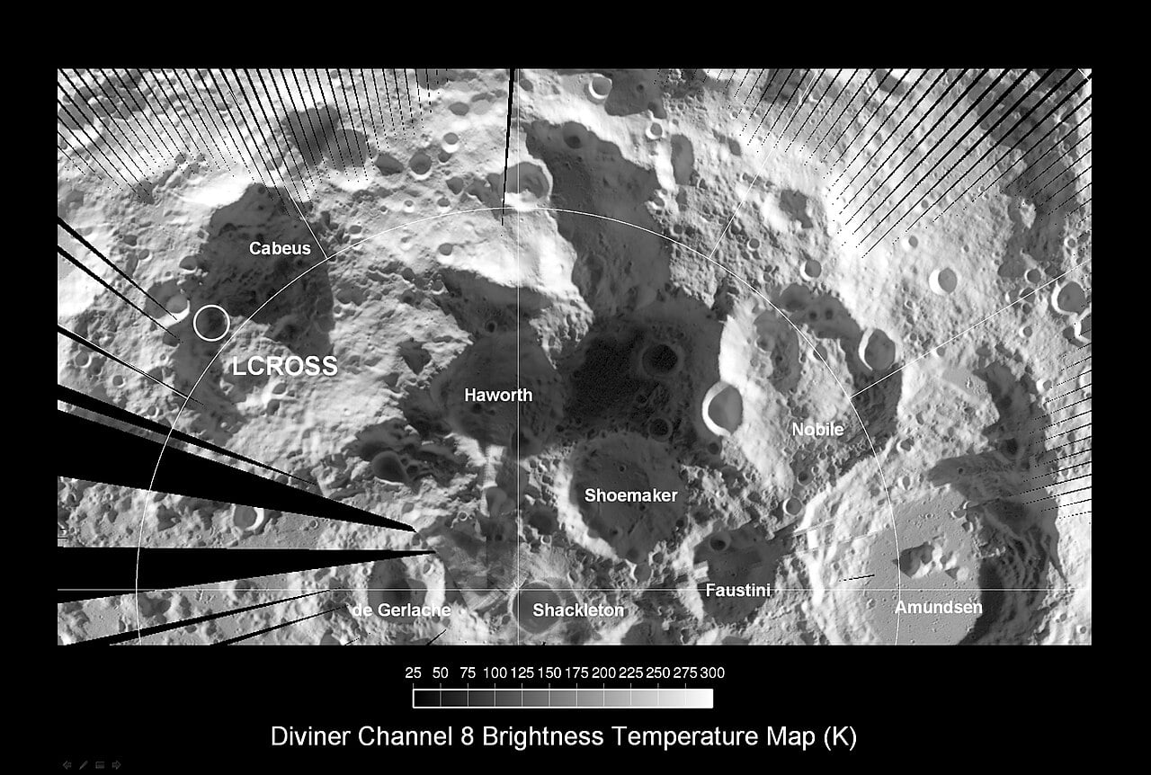
Radar data unveils the complex subsurface structure of the lunar south pole, crucial for Artemis landing site selection and resource utilization.
Explain Like I'm Five
"Imagine using a special flashlight to see what's under the Moon's dusty ground! This helps us pick the best spots to land and dig for ice."
Deep Intelligence Analysis
_Context: This intelligence report was compiled by the DailyOrbitalWire Strategy Engine. Verified for Art. 50 Compliance._
Impact Assessment
Understanding the lunar south pole's subsurface is vital for Artemis missions, influencing landing site selection and resource extraction. Identifying buried melt sheets and regolith composition is critical for mission success.
Read Full Story on Universe TodayKey Details
- ● Radar data combines Mini-RF (12.6 cm wavelength) and Arecibo Observatory (P-band) data.
- ● Circular Polarisation Ratio (CPR) indicates surface roughness and geological history.
- ● High CPR values in smooth plains suggest ancient fluidized ejecta.
- ● Subsurface architecture impacts landing zone safety and drilling viability.
Optimistic Outlook
Detailed radar mapping enhances the precision of landing site selection, potentially leading to safer and more efficient lunar operations. Understanding subsurface resources could accelerate in-situ resource utilization (ISRU) efforts, paving the way for sustainable lunar bases.
Pessimistic Outlook
The complexity revealed by radar could pose unexpected challenges for landing and resource extraction. Misinterpreting subsurface structures could lead to mission failures or delays, increasing costs and timelines.
The Signal, Not
the Noise|
Get the week's top 1% of space-tech intelligence synthesized into a 5-minute read. Join 25,000+ aerospace insiders.
Unsubscribe anytime. No spam, ever.