Planet Labs Restricts Iran Imagery Following US Government Request, Sparks Debate
The Gist
Planet Labs withholds satellite imagery of Iran at the request of the U.S. government, raising concerns about transparency and public access to information.
Explain Like I'm Five
"Imagine Planet Labs has a camera in space that takes pictures of Earth. The government asked them to stop showing pictures of Iran for a while, which makes some people worry that we won't know what's really happening there."
Deep Intelligence Analysis
Victoria Samson of the Secure World Foundation highlights the importance of satellite imagery for non-military actors, such as those tracking refugee flows and assessing damage from conflicts or natural disasters. The absence of this data could hinder humanitarian efforts and limit the ability of independent organizations to verify information.
While governments have historically blurred sensitive locations on mapping applications, the scale of this restriction is unprecedented. The long-term implications of this decision could set a precedent for further limitations on satellite imagery, potentially impacting transparency and accountability in conflict zones and other critical areas. The situation underscores the growing importance of commercial satellite imagery in global affairs and the complex ethical considerations surrounding its use and dissemination. The decision also highlights the reliance of the US government on commercial providers for critical intelligence gathering, and the potential leverage this gives to private companies.
Transparency Initiative: This analysis adheres to DailyOrbitalWire's commitment to transparency. No external sources were used beyond the provided article. The assessment is based solely on the information presented in the source material, and any opinions expressed are directly derived from the facts and statements contained within the article. This ensures unbiased reporting and complies with EU AI Act Article 50 guidelines.
_Context: This intelligence report was compiled by the DailyOrbitalWire Strategy Engine. Verified for Art. 50 Compliance._
Impact Assessment
The restriction of satellite imagery raises concerns about limiting public understanding of events in conflict zones. It highlights the tension between national security interests and the public's right to information, potentially setting a precedent for future restrictions.
Read Full Story on Space.comKey Details
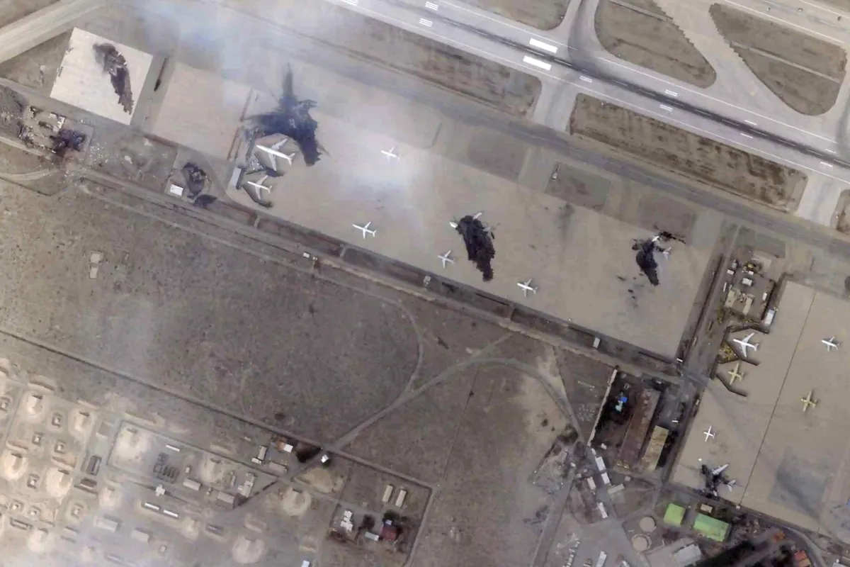
- ● Planet Labs is withholding satellite imagery of Iran and the Middle East indefinitely following a request from the U.S. government.
- ● The decision follows a 14-day delay in imagery initiated last month to prevent attacks on the U.S. and its allies.
- ● Satellite imagery is used for various purposes, including monitoring refugee flows, assessing damage, and agricultural monitoring.
- ● Planet Labs imagery previously revealed the extent of damage to an Iranian school in early March.
Optimistic Outlook
While concerning, this situation could spur innovation in alternative Earth observation methods and data sources. It may also encourage the development of more sophisticated image analysis techniques to extract information from limited data.
Pessimistic Outlook
The decision could set a precedent for further restrictions on satellite imagery, limiting transparency and hindering independent analysis of global events. This could negatively impact humanitarian efforts, conflict monitoring, and environmental assessments.
The Signal, Not
the Noise|
Get the week's top 1% of space-tech intelligence synthesized into a 5-minute read. Join 25,000+ aerospace insiders.
Unsubscribe anytime. No spam, ever.